
My unique business model has allowed me the opportunity to hunt many different locations and species. From Mexico to the Northwest Territories, the west coast of British Columbia to the east side of the Rockies, and most places in between. The adventure of the chase is what keeps me going, year after year, and the challenge and expectations of these mountain hunts always force me to do my homework.
Clients, other outfitters, and local hunters always ask me how I get it done in an area that I haven’t hunted before or know nothing about. I usually don’t go into depth…but I will give you some inside information as to how I tackle the unknown, and usually come out heavy.
First, listen to everything anyone wants to tell. I’m not a guy that asks for Intel or someone’s honey hole, but it’s amazing how people like to share their experiences – especially older guys who are willing to pass it on. Take it all in — you never know when it might come in handy.
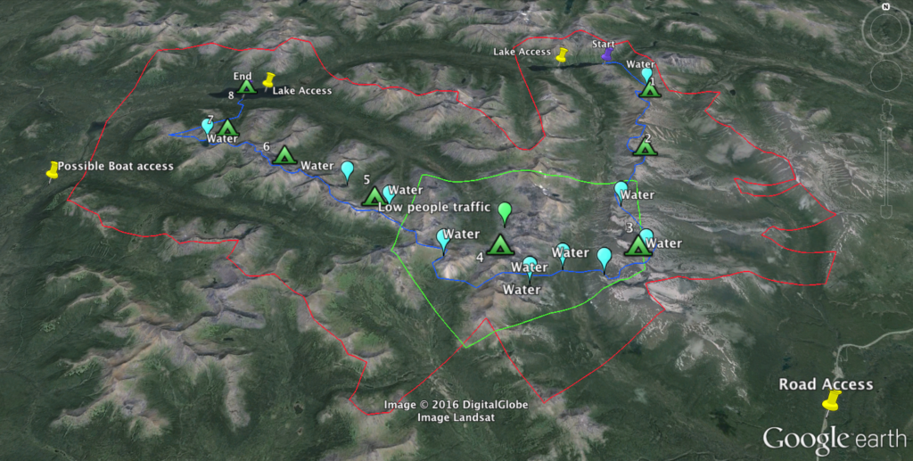
Next comes the most important pre-hunt preparation: mapping. Advances in technology play a huge part in the success of today’s hunter. Companies are building detailed mapping systems for handheld devices that give us an edge over hunters of the past. My entire season, hunt after hunt, is planned months ahead of time. I typically use Google Earth, but there can be areas that are not very clear – especially in the remote parts of the North – so I also refer to Bing Maps to look at up-to-date mapping of the terrain and weather. Google Earth has many more functions for planning your trip, but Bing has very detailed images when you want to look at passable routes, trails, camps, or water sources. Use them both and take advantage of the best of each.
After I determine what general area I want to attack, I begin to seek out access points for the entire area: sizable lakes to land on or dirt airstrips, roads, ATV trails, and boat access. I will then put pins on my maps to note these locations. Even if I’m not using a jet boat or ATV, for example, I still need to know if and how anyone else may be getting into the area and whether or not I’ll have visitors on my trip. I want to get away, especially in high-traffic areas.
Once I have all possible access points marked, I look for places that I think others won’t be able or willing to reach. I want to find a barrier such as a nasty mountain range, or a river that may be un-passable or just plain too far for most guys (seems to be the latter in most cases). I circle these spots and will try to hit as many as possible when I actually get on the ground.
After dealing with the access options, I’ll also note small lakes or ponds or any other water source I can see (usually in a different color pin). This plays a big role in planning a hunt, especially in situations where water can be sparse. Water is a must on any hunt and can be the determining factor that may keep you going…or not!
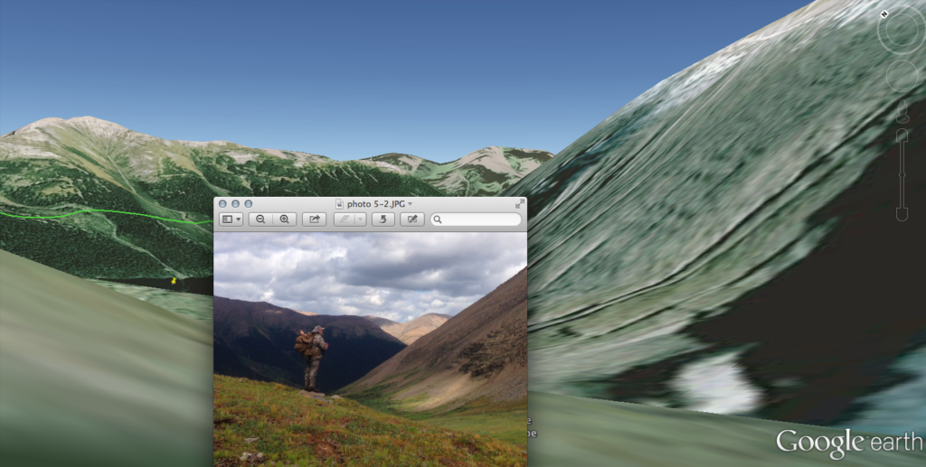
When I have my likely areas marked, I will plan a route. My trips are usually booked as ten-day hunts, so I typically try and plan a 25- to 30-mile travel plan over eight full days with two days extra to allow for unforeseen circumstances. If necessary, I can usually make adjustments to make up time, such as taking the shortest path to point of pick-up. My trail is planned to allow my eyes to look over as much as possible – way more than my feet can possibly access. Sometimes it’s a loop, sometimes it’s a down-and-back, and sometimes it’s a lake-to-lake, road-to-lake, strip-to-lake, or even lake-to-wherever-the-hell I end up. I should mention: hardly ever does my blue line (hunt path) on my map represent where my boots actually hit the dirt. Google Earth never does the mountains justice, nor does it show what it’s really like in the remote backcountry. That said, it does allow me to have an idea of what my options are and where to put effort into looking.
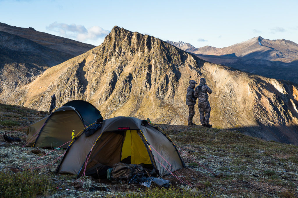
My blue line is usually placed to direct me to the best spots for my hunting skills to take over. Setting myself up for the highest chances of spotting a sheep is a big part of the agenda. I will also place pins on my map that break down the distance and help evenly space out my days. Usually these markers are good camp spots (“a room with a view”) or, on occasion, the valley floor as I switch from range to range. I like to camp on top as much as possible, but it’s also good to spend one night every so often camped in the bottom. A good fire and rehydration before pushing onward to the next range will always help morale and recovery.
The marked path is great if you can follow it but most of the time it’s just a guideline, and once you live it, you may venture off of it, especially when a twister catches your eye. Most of the good sheep hunters will tell you it’s about looking and patience. Running all over the country isn’t what puts sheep in your pack – keep that in mind when designing your plan. You need to be where you can see. Looking the last hours and the first hours of each day will set you apart and greatly increase opportunity. Travel mostly during mid-day, only when everything has been picked apart, and look more than you walk.
This style of mapping is a tremendous asset when hunting new spots. I usually feel like I know the area without ever actually being there. I spend hours studying the area and also have these maps with me on the hunts, both in printed versions as well as on my phone. I can reference them often, seeing what’s over the top or spying additional secondary paths should I run into obstacles – and we’ve all had our share of obstacles!
Now that I have a plan and the hunt arrives, I can make adjustments as needed. I may spot a mountain that has a ton of trails or even sheep, what’s that old saying about a bird in the hand? When sheep show up, the plan gets rearranged and it’s time to go get them! More often than not, though, my trip goes according to the plan and sooner or later we will find game. I make sure to plan my trip to cover every square inch, leaving no rock unturned.
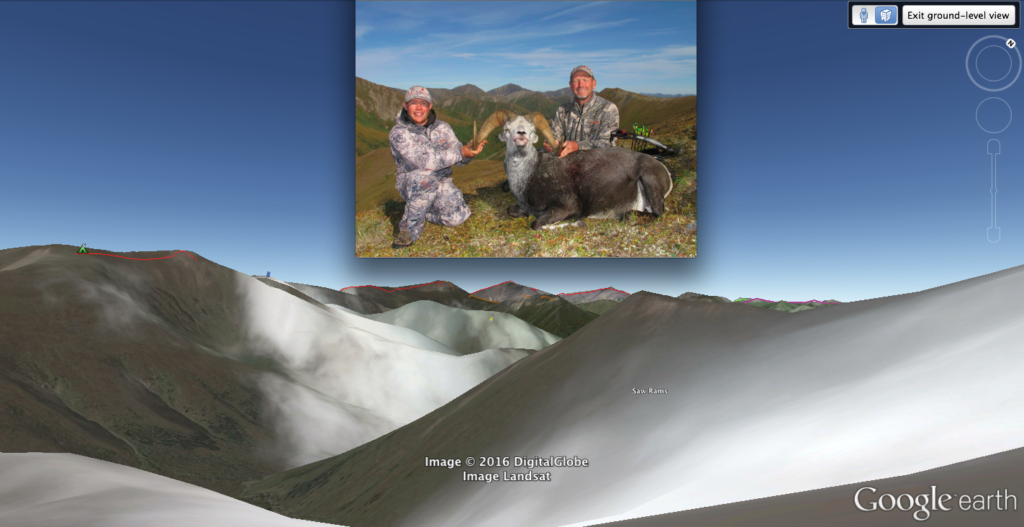
During the hunt I’ll mark where I’ve seen sheep on my print-offs, and after I return home I transfer that information to my Google Earth database. I always refer back to that when planning other trips and look at where they like to be. Facing slopes, vegetation, cover – all this tells me where sheep will likely be spending time. And it works. Different sheep use and like many different surroundings, but in general, within a zone they will be in similar locations. Over time, and with some trial and error, you will be able to narrow down likely places and increase your chances.
A couple years ago, I hunted an area that only had one lake to fly into. I talked to previous guides that hunted it and the feedback was universally negative. One guy hunted there for five years and never laid eyes on a legal sheep! I was a bit discouraged, as my plans were already made to go here. When we landed, I put my head down and walked two full days (August days!), and on day three we killed a 40-inch, 12-year-old monarch who was the leader of five other good ones. My point is that the sheep learn to live where they aren’t bothered. You need to find and hunt these places; dig deeper than others are willing. My pre-made maps had outlined the features previously mentioned, so because of the past guides indicating very little sheep were in this area, I ventured right out, and we killed this ram in the center of my “low human traffic” marker.
Every area that has a sheep quota will have rams. I’m never worried about hunting an area that people call “bad” and not finding sheep. They are there; you just need to find them. To be honest, these “bad” areas have accounted for some of the best rams in my photo book. I don’t think they are bad areas at all – I think guides get lazy, some hunters don’t do what it takes, and you need to be there to be lucky.
The hunter that can push past the obstacles that any sheep hunt brings and is prepared mentally, and most importantly plans thoroughly will prevail. Due to my countless hours of study and carefully making a hunt plan like this, I have been way more successful than if I had not. I believe planning equals success.
Try it out, or even mark your past successful hunts on your maps. Start building a database. Not only will you learn, but it’s also something worthwhile to do while we all wait for opening day!